
Trace One Temecula Street Address
A useful Temecula street directory workflow moves from the address to a parcel, from the parcel to an owner record at the assessor counter, and from that name to the recorder's index. It then checks what voter law permits and uses GIS, permits or older sources only as supporting evidence. The chain is deliberate because Riverside's online property search returns an APN and assessment information without publishing the owner name, while the recorder index is built around people and recorded instruments rather than a dependable street-address search.
- Start with the address. Confirm whether the mailing identity is inside incorporated Temecula. Wine Country, De Luz, Morgan Hill and other postal-Temecula areas may be unincorporated, which changes the permit and code-record custodian.
- Turn the address into an APN. Use Riverside County Property Search with the street number and street name only, or use the parcel number if it is known. Record the APN, situs and assessment details.
- Take the APN to the assessor owner counter. Riverside ACR suppresses owner names from the public web display, but the January 1 ownership roll is available for public inspection at an ACR office under Revenue and Taxation Code section 408. Keep the tax mailing address separate from the situs.
- Move from owner to recorder. Search the ACR name index in
LAST FIRST MIform. Find the acquisition deed, note the grantor, legal description and document number, then search that earlier owner as a grantee to walk the chain. - Respect the voter limit. My Voter Status lets a person check their own registration details. It is not an open list of everyone on a Temecula street, and the statewide file is limited to approved statutory purposes.
GIS, permits and historical directories can add context after the core chain is anchored. They can show how a parcel fits its block or when work occurred, but they do not turn an address into a verified list of every person who lives there.
Note: A street search identifies a parcel and record trail, not every household member at the address.
Temecula Records Along a Street
Address-keyed records in Temecula sit across several custodians. The assessor connects a street string to an APN. Riverside GIS supplies a visual parcel context. Recorded deeds and liens require a party-name search. City permits describe work, applications and inspections. Tax bills add a fiscal-year snapshot, while planning-notice workflows can produce nearby owner mailing labels under a specific radius process. These layers overlap, but none is a resident register.
| Record layer | Custodian | Useful evidence | Street access |
|---|---|---|---|
| Assessor ownership roll | Riverside ACR | APN, situs, value and owner or mailing address at the office | Web address/APN search; owner inspection at an ACR office |
| Parcel and GIS map | Riverside Map My County and city GIS | Adjacent lots, tract, zoning, hazards, HOA and boundary context | Free interactive map and parcel reports |
| Deed and lien index | Riverside ACR Recorder | Parties, recording date, instrument type, document and book/page references | Web index from 1974; Gateway Riverside for older research |
| Secured tax bill | Riverside Treasurer-Tax Collector | PIN, fiscal year, taxable party or address and amounts; see the secured property-tax information route | Portal or counter; duplicate bill requests are available |
| Permits and code files | Temecula Community Development or county desk | Applicant, contractor, scope, valuation, inspections, notices and dates | Online services or targeted records request |
| Planning notice list | City GIS or title professional workflow | Nearby owner names and mailing labels for a notice radius | Parcel map, radius and CSV or label workflow |
| Voter information | California Secretary of State and elections officials | Personal status, district and participation fields when lawfully available | Self-status tool or approved-use file guidance only |
The APN is the bridge. It lets a researcher keep one parcel steady while a street label, mailing address or record type changes. A deed proves a conveyance, an assessment roll shows taxable ownership at a roll date, and a permit dates work. A voter record, where lawfully obtained, speaks to election administration rather than title. Read the evidence by its purpose instead of treating every name as proof of occupancy.
Temecula Street Search Fields
The Riverside property portal offers a narrow but useful first pass. Its public web result is designed to locate a parcel. The absence of an owner name is intentional. Use the smallest street input that the form requests, save the APN and situs, and then take that identifier to the permitted in-office ownership lookup.
| Field label | Type | Required | Format or option |
|---|---|---|---|
| Search choice | Radio or tab | Yes | APN; Property Identification Number, also called PIN or Assessment No.; or Property Address |
| APN | Text | Conditional | Use the parcel number supplied by the record or map |
| PIN | Text | Conditional | Use the first nine digits; omit the dash or check digit |
| Property Address | Text | Conditional | Street number plus street name, such as 123 Main; omit suffix and city |
| Search | Button | Yes | Returns parcel and assessment location; no online owner name |
The county FAQ explains why an address hit can feel incomplete: ownership is public at the permitted counter, but the ordinary online result omits it. That boundary is central to a careful street directory. An APN match is still valuable because it prevents a similar street name, a mailing address or a neighboring lot from being carried into the next search.
The ACR assessor FAQ shows the distinction between the online property result and office access. The screen is a parcel-finding aid, so retain its identifiers before moving to the next custodian.
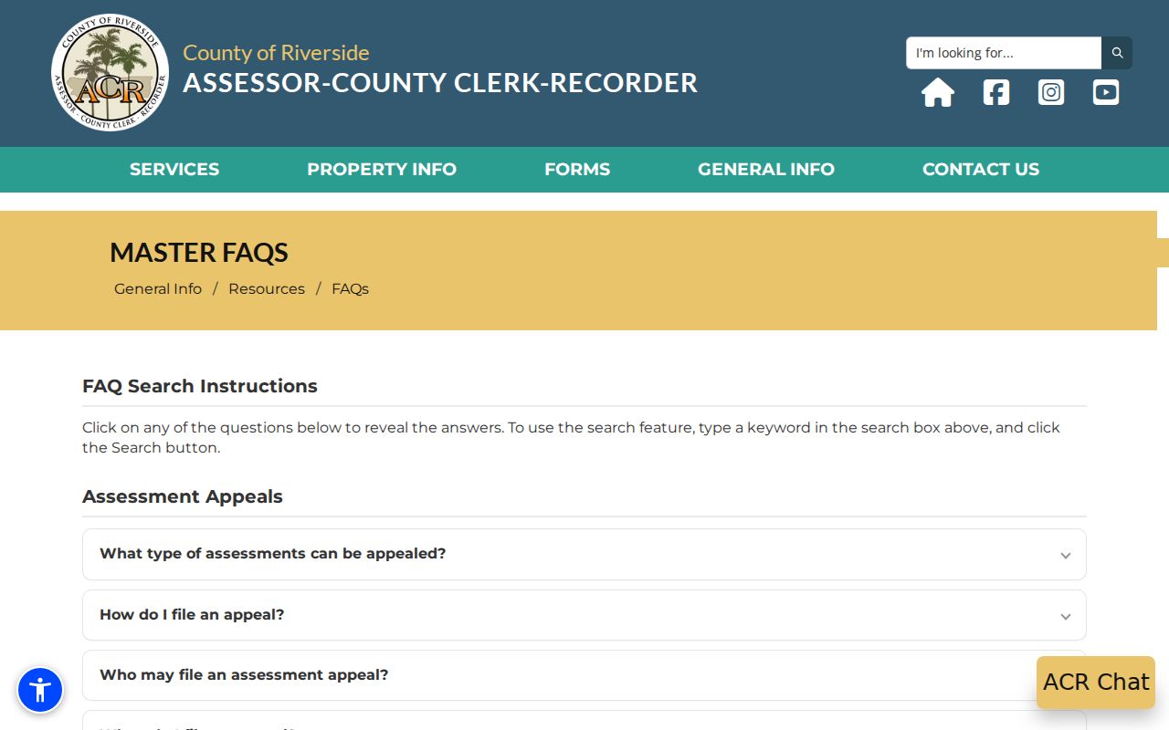
The assessor image reinforces the local rule: a web address search can locate the land, while the owner lookup belongs at an ACR office under the stated public-inspection authority.
Map a Temecula Street Block With GIS
Riverside Map My County is a free interactive parcel viewer. Pan, zoom and identify adjacent polygons to see how a street segment relates to parcel lines. City GIS adds roughly 70 layers, including parcels and addresses, HOA geography, zoning and general-plan layers, tract and parcel maps, city boundary and sphere information, council districts, schools, parks, public facilities, maintained streets and hazard layers such as fire, flood, fault and liquefaction. A parcel polygon is useful context, not a legal boundary survey.
- SearchByAddress or APN selects the subject parcel.
- SearchByTractAndLot bridges a street result to a legal subdivision reference.
- Street Intersection locates a block segment when a full address is not yet known.
- Radius or area identify gathers nearby parcels around a chosen point or parcel.
- Parcel Report and CsvMailingLabels turn the selected set into parcel detail or owner mailing-label output.
The documented radius workflow is precise: search an address or APN, designate the parcel or area, choose a radius, review the nearby parcel set, then run a report or mailing-label action. Conditional-use notice instructions show one real planning use. The applicant supplies an assessor parcel map, owner names, at least 30 different owners even when a 600-foot radius is used, two label sets and professional certification. The assessor does not create or certify the list. That is an adjacent-owner notice process, not a household directory.
Note: County and assessor data are updated for public use but supplied without a survey warranty.
Riverside Deeds Build a Temecula Street Trail
The Riverside ACR records landing page offers Name Search, Document Number Search, Document Type Search, Map Type, Book/Page and Advanced Search. Recorder documents are indexed online from January 1, 1974 forward. Clerk documents have an earlier January 1, 1893 index boundary, so those dates must not be blended. The recorder search is not a dependable way to type a street and receive every owner. Begin with the current owner name obtained through the assessor office, then test spelling, middle initials and party role.
For each useful hit, save the recording date, instrument type, document number, book/page or map reference, named parties and legal description. A deed is a conveyance. A deed of trust, reconveyance, lien, release or notice may explain a transaction without proving that the named party lives at the situs. The record gives public notice of an instrument, not a current occupancy finding.
The online copy route lists a regular first page at $8, each additional page at $1, certification at $2 per document and a 2.15% online card fee. Average online processing is 48 hours, with mailed copies. An office request can use an SST number and “In Office” selection, with same-day service typical unless research is extensive. Mail requests need a document number or title/type, parties, an estimated recording date and a helpful APN. Pre-1976 requests without a document number are limited to two years after the estimated year. Use a Gateway Riverside visit for 1974 and earlier deed-book research.
The ACR name-search form is the practical handoff from an address-led search to a person-led chain. It helps explain why the street directory owns the first parcel step, while the recorder owns the backward grantor-grantee trail.
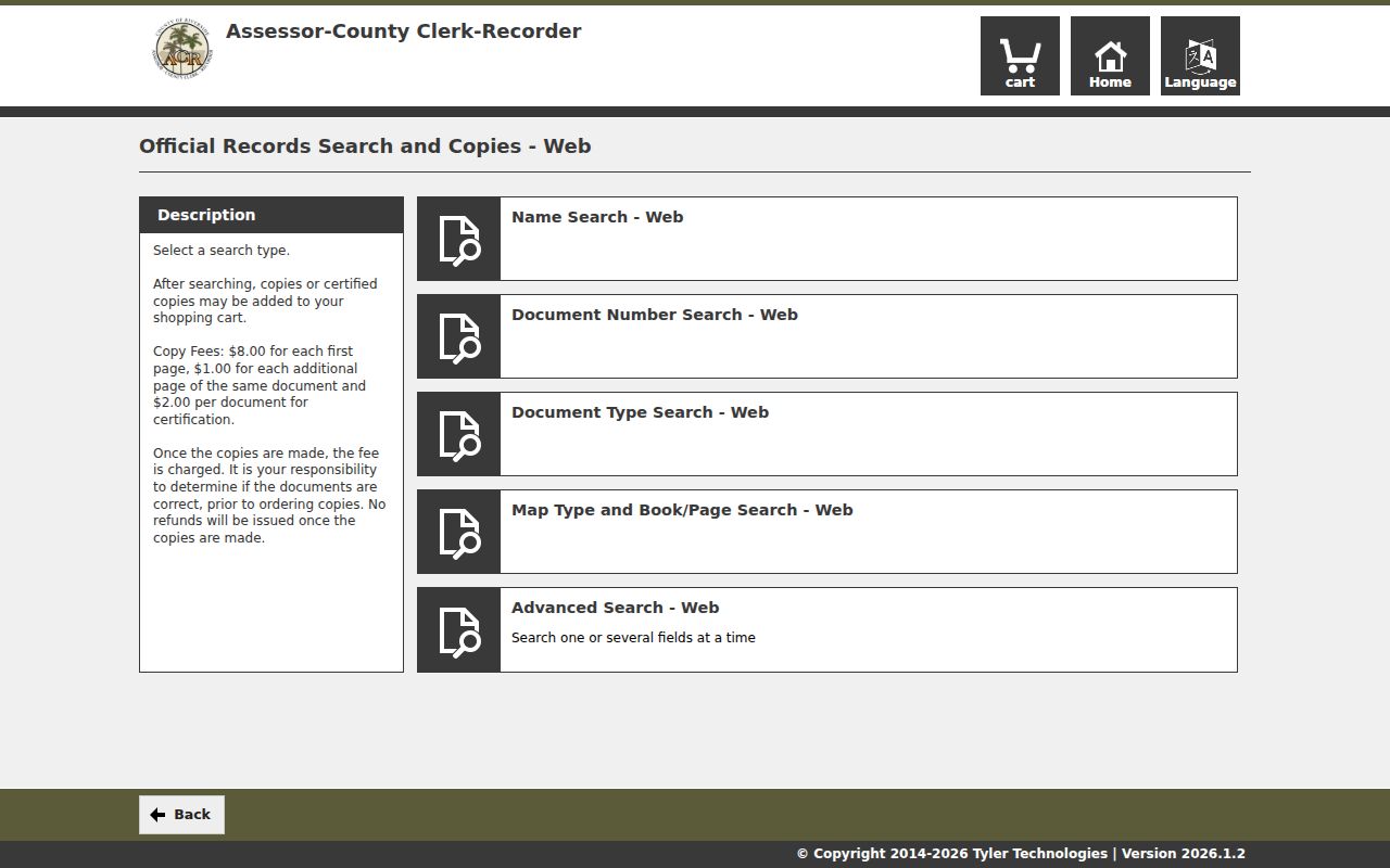
The recorder screen belongs after the parcel and owner steps. It is strongest when a known party name and date range are already in hand.
Temecula Street Permits Date Work
Temecula Community Development says permit services are available online. For an address trail, Building and Safety is at 951-694-6439, Permit Center and Planning at 951-694-6444, Code Enforcement at 951-302-4144, Land Development at 951-694-6411 and Community Development at 951-694-6476. A targeted request can ask for permit history, building cards, plans, certificates of occupancy, planning entitlements and final inspections. Include the street address or APN, a date span and the record type.
Permit and inspection files can connect a property to an applicant, contractor, owner representative, project description, valuation and milestone dates. Code files may show a complaint, inspection, notice and resolution date, but privacy and enforcement exemptions can apply. The named applicant or contractor is not automatically the occupant. For a postal Temecula address outside city jurisdiction, use Riverside County Building and Safety rather than the city desk.
The Temecula Community Development page is the right starting point for current city routing and permit contacts.
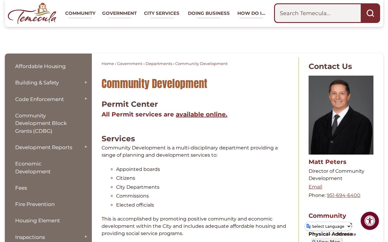
The image connects the street record to a city-created address file, while the evidence rule keeps a project contact from being mistaken for a resident.
Temecula Place Names Change the Street Search
A modern street directory can fail when an older record uses a different geography. Temecula's research trail has at least four frames: the original Pechanga village area near Temecula and Murrieta Creek, a later settlement upstream near today's Redhawk bridge, Old Town after the railroad arrived in 1882, and the incorporated city after the November 1989 vote. The first post office and Butterfield station date to 1859. Before Riverside County was organized in 1893, an event may be filed under San Diego County or another predecessor geography.
Search “Rancho California” for pre-incorporation material and treat Pechanga, Wine Country and Old Town as geographic clues rather than automatic city-limit labels. The city's street-name history ties names to Indigenous terms and pioneers or landowners, which helps explain an alias or place reference. No universal Temecula street-renumbering year was verified. When a street label does not resolve, use the APN, tract and lot, map book or legal description to hold the parcel steady.
That approach matters during the growth period. Temecula grew from about 200 residents in 1970 to 1,783 in 1980 and 27,099 in 1990, while the recorder's online index begins in 1974. Much of the subdivision-era chain may be searchable online by owner name, but ranch and community-era work still needs Gateway books, Fitch Archives, maps or historical collections.
Temecula Street Directory and City Limits
Postal identity and municipal jurisdiction do not line up perfectly. The three main ZIP codes used for the Temecula area are 92590, 92591 and 92592, and city planning material warns that they include large rural areas outside the incorporated city. In practical terms, 92590 reaches west Temecula and Old Town, 92591 covers central and north corridors around Rancho California Road and County Center, and 92592 reaches south and east areas near Pauba, Redhawk and Pechanga-facing places. These are qualified place descriptions, not legal USPS polygons.
For a current address, verify the delivery city and ZIP with the USPS city and state lookup, then verify city jurisdiction before requesting a permit, code file or city CPRA record. The Temecula Post Office example at 30777 Rancho California Road is in 92591, with stated counter hours Monday through Friday 9-5 and Saturday 10-3. The Roberts Library address in 92592 illustrates why a familiar Temecula place can sit near a wider postal geography.
The USPS lookup screen is a delivery check, not an owner or resident source.
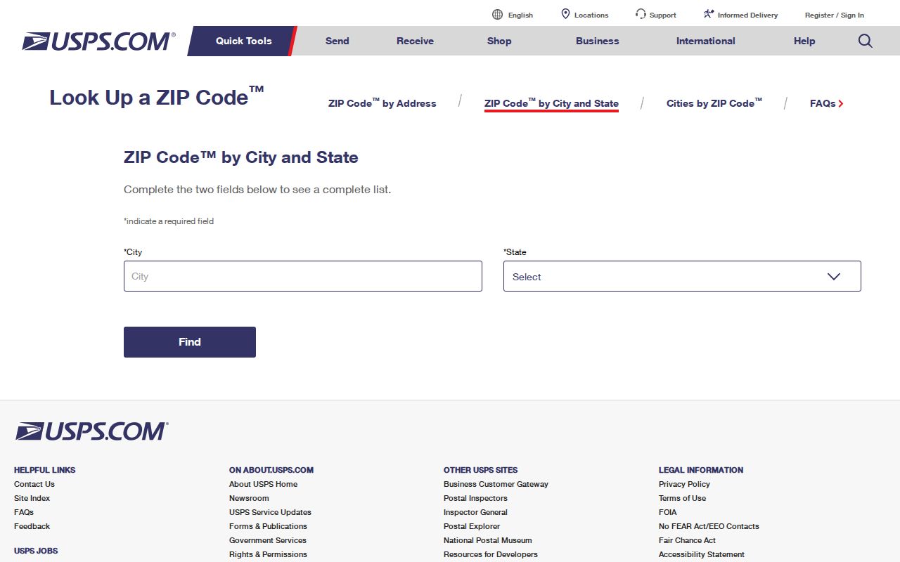
Use the ZIP result to route mail and records requests, then return to the parcel and jurisdiction checks before treating an address as part of the city.
Voter Records Do Not Browse a Temecula Street
California's My Voter Status tool is a personal verification service. A user supplies identity and residence details to see registration status, party preference, polling place, vote-by-mail status and election information. That output can help someone check their own record, but it cannot be used as a casual Temecula street directory or an open name search.
The statewide voter file is limited to authorized election, governmental, scholarly, journalistic or political purposes under Elections Code sections 2188 and 2194 and California Code of Regulations, title 2, sections 19001-19013. A statewide file costs $100. A specific-voter request costs $30 per record up to $100 and is limited to ten named voters per application. Applications identify the requester, beneficiaries, lawful purpose, intended use, security controls and declarations, and are submitted by person, mail or courier with current photo identification and payment. Email and fax are not the stated routes.
Voter fields can include name, county, registration identifiers, residence and mailing address, party preference, status, registration date, precinct, districts and participation history. Protected voters are suppressed. Participation shows whether and how a ballot was cast, never the choices made. Safe at Home participants use a confidential registration card and call 877-322-5227. A list-status change does not establish the exact date a person left an address.
Criss-Cross Claims in a Temecula Street Directory
A criss-cross directory is a street-order section that can let a researcher move from an address to a listed name. A reverse directory uses the same general address-to-person idea. A householder index points to household heads or another named entry set. Those definitions are useful, but the local holdings question must be answered separately.
- Parcel
- A mapped piece of land identified by an APN; it is the stable bridge between an address, assessment and map context.
- Situs address
- The physical location assigned to the parcel. It is distinct from a tax mailing address.
- Plat or legal description
- A recorded land description, often using tract and lot or map references, that can preserve continuity when a street label changes.
- Criss-cross directory
- A possible address-order index of people or households. It should be claimed only when a catalog or inspected volume verifies the local run.
No authoritative local catalog verified a Temecula Polk, telephone, reverse or criss-cross run, and no exact publisher or year range should be invented. The verified 1893-94 Bynon county volume is arranged by community and is not proof of a modern reverse directory. The Temecula city directory collections record the research gap and the library or museum reference route.
Ask both Temecula library branches and the Temecula Valley Museum for a catalog or reference check. The Ronald H. Roberts branch can also point to newspapers, yearbooks, genealogy databases and vertical files. A staff answer about a shelf is stronger than assuming a familiar national directory publisher was stocked locally.
What a Temecula Street Directory Cannot Show
Owner, tax mailing addressee, situs and current occupant are not synonyms. A remote owner, trust or business mailing address may be the best public clue without showing who sleeps at the property. People outside the ownership roll and other household members are not supplied by the assessor. Utility and delivery customer lists are not open street directories, and California DMV address data is generally protected by the federal Driver's Privacy Protection Act.
Even an official-looking name needs a second source and a date. Pair an APN with a deed legal description, a court party with a case number, or an address-created permit with its project record. Correct a false business, license or court match with the originating custodian. The California Public Records Act can request an existing, identifiable, nonexempt city or county record, but it cannot force an agency to create a resident directory or disclose protected personal data.
Lawful use. Temecula address and parcel records support personal, lawful research. Do not use a street directory to stalk, harass, intimidate or threaten anyone; California Penal Code sections 646.9, 653m and 653.2 address stalking and malicious or harassing contact.
If the goal changes from tracing every parcel on a street to verifying one person, use the Temecula resident lookup by name workflow and keep the address evidence separate from conclusions about residence.